Product // Map Maker Platform

The Digital
Twin
Advantage

Map Maker transforms raw sensor data — drone imagery, LiDAR, video, sonar, satellite — into photorealistic 3D digital twins in minutes, not months. Fully offline. Fully automated. Fully yours.
6
Continents Deployed
100%
Offline Capable
<20min
Raw Data to 3D Model
ALL
Domains Covered
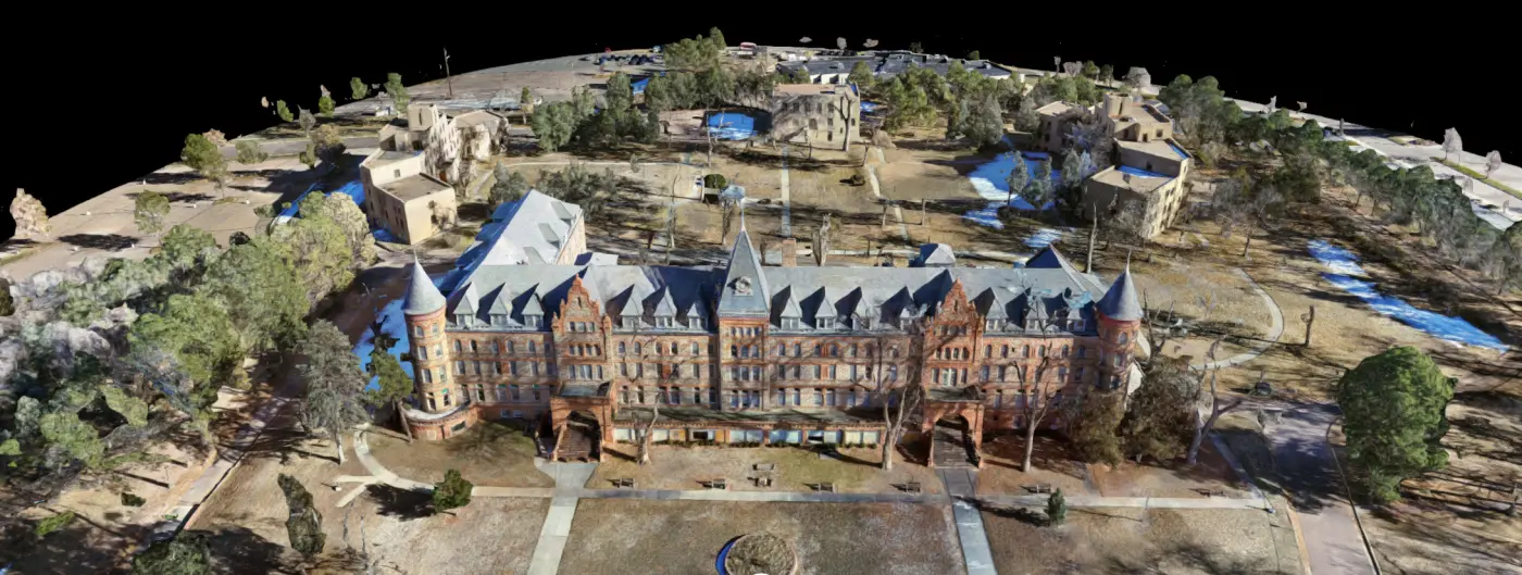
Map Maker 3D digital twin — campus aerial
◈ DIGITAL TWIN ACTIVE
27.43.12N / 082.39.45W
STATUS
● LIVE
ACCURACY
±2.1 cm
RESOLUTION
1 cm/px
◈ MAP MAKER 3D
Core Capability

3D Reconstruction

Map Maker ingests raw imagery, LiDAR point clouds, and video — then autonomously produces photorealistic, geo-referenced 3D models. No internet required. No specialist needed. From field collection to explorable digital twin in under 20 minutes.
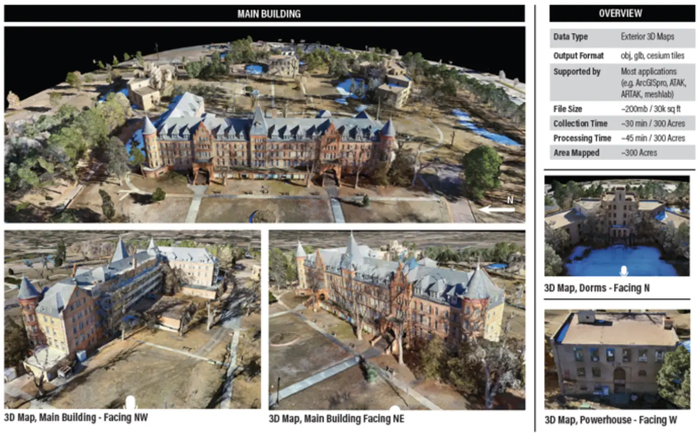
Map Maker 3D reconstruction — building exterior with data panel
Capture
Process
Generate
Deploy
Supported Inputs
🛸
Drone / UAS
Imagery & video from any UAV
📡
LiDAR
Point cloud & mesh data
🎥
Video
EO/IR footage
🖼️
Images
Ground or aerial photos
📐
360°
Panoramic capture
🔭
Sonar
Underwater sensors
🏗️
Photogrammetry
Multi-image surface reconstruction
🛰️
Satellite Imagery
High-resolution satellite data
Below Ground & Inside Structures

Interior & Subterranean Mapping

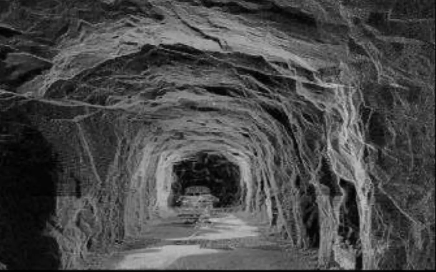
Where GPS fails and traditional mapping stops, Map Maker excels. Capture multi-level interiors, tunnels, subways, and underground facilities with handheld LiDAR — producing layered 3D models that reveal every room, corridor, and access point.
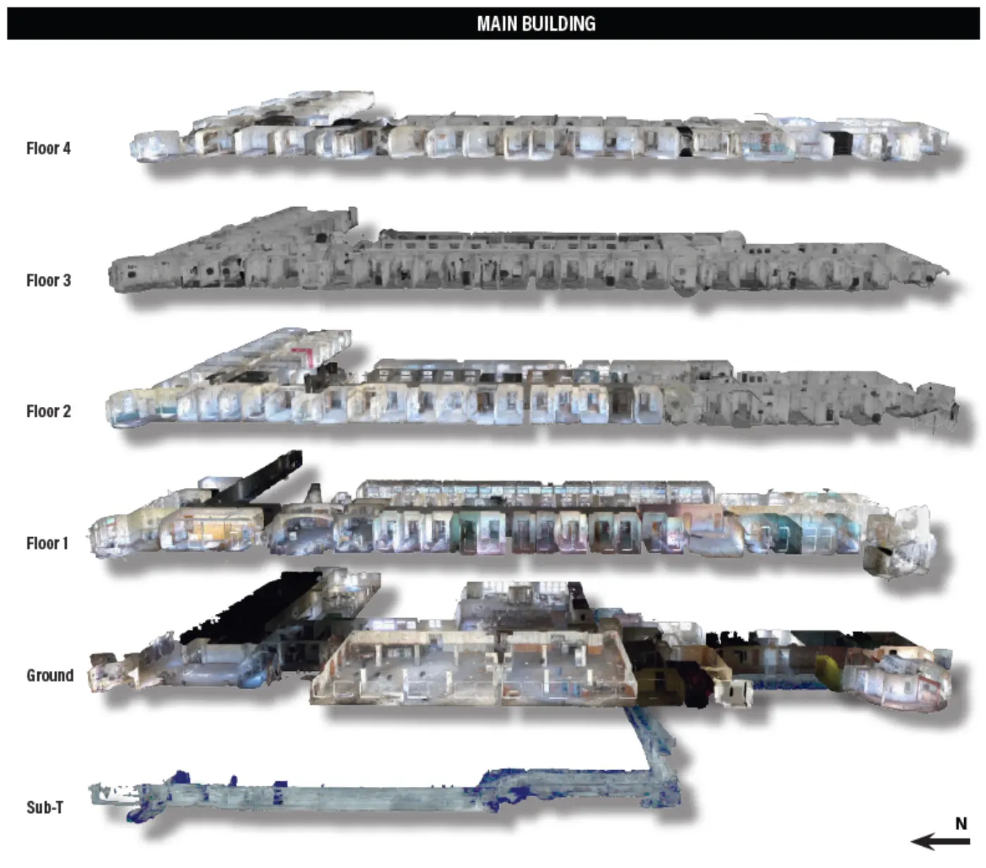
INTERIOR // MULTI-LEVEL
Interior LiDAR scan — layered floor plan breakdown
SUBTERRANEAN // TUNNEL SCAN
LiDAR tunnel scan — subterranean environment
Subway SystemsMilitary BunkersTunnel NetworksBuilding InteriorsCave SystemsUtility Infrastructure
◈ GPS-Denied Environment Ready

Map the unmappable

Handheld LiDAR sensors capture sub-surface and enclosed environments where drones can't fly. Map Maker automatically stitches scans into a coherent, multi-level 3D model with room classification, corridor navigation paths, and structural analysis.

Multi-Level Mapping
Simultaneously models ground, sub-level, and deep infrastructure in a single layered output.
Structural Analysis
Identifies walls, load-bearing elements, access points, and bottlenecks for tactical planning.
Subterranean Nav
Generates navigable path data for tunnels, corridors, and underground networks.
Offline Processing
No connectivity required. Process in the field, export to ARTAK or any compatible platform.
SensorCaptureOutput
Handheld LiDARWalk-throughFull 3D model
Backpack LiDAR5–15 minPoint cloud + mesh
360° CameraRoom-by-roomPhoto-textured model
Maritime & Subsurface

Underwater Mapping

Map Maker processes electro-optical underwater footage and sonar data into 3D bathymetric models of seabeds, submerged structures, and maritime environments — enabling port security, salvage operations, and ISR missions below the waterline.
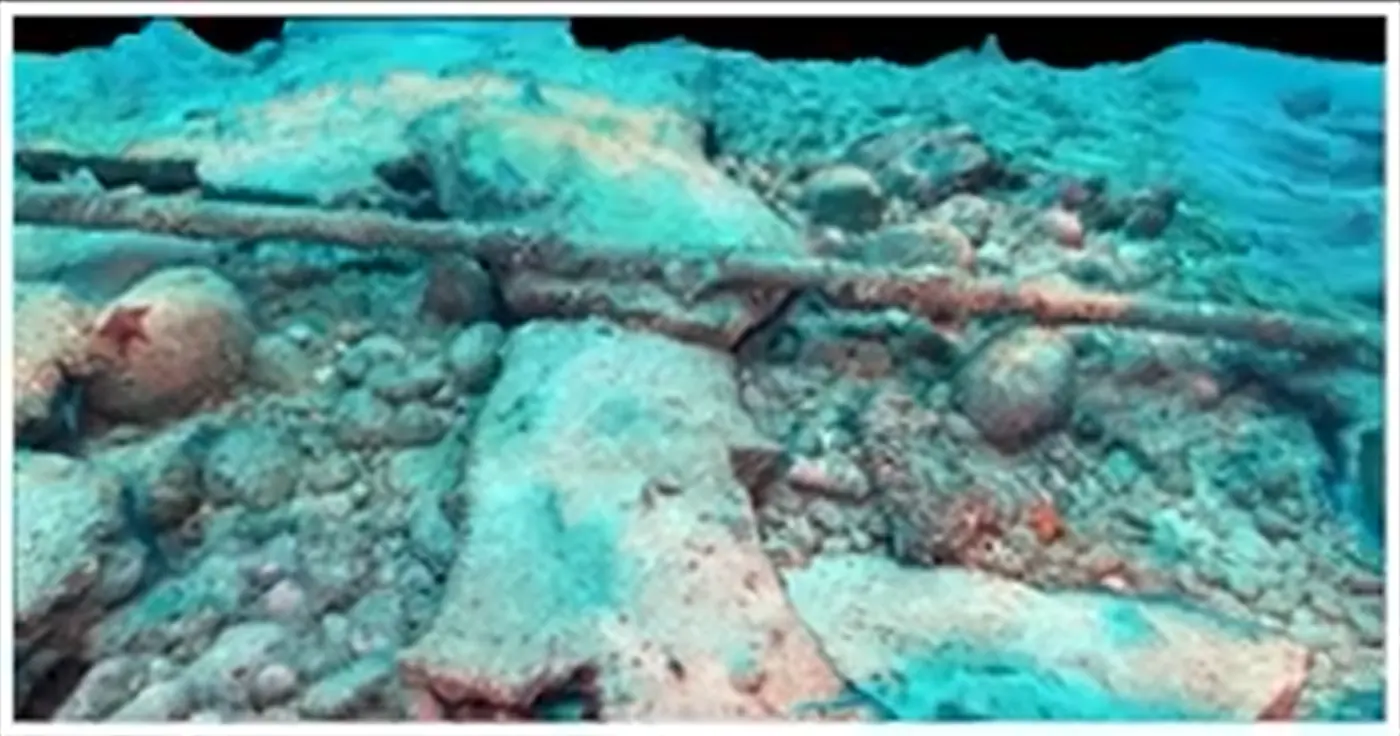
Bathymetric Modeling
Converts sonar sweeps and underwater video into accurate seafloor terrain models with depth contours and obstacle mapping.
Hull & Structure Inspection
Create detailed 3D models of ship hulls, bridge foundations, and submerged infrastructure for inspection and analysis.
Port & Harbor Security
Generate persistent digital twins of ports, piers, and littoral zones to detect changes and support force protection planning.
Wreck & Obstacle Detection
Identify and map submerged wrecks, debris fields, and navigational hazards with precise geo-referenced coordinates.
Map Maker underwater 3D scan
MODE
BATHYMETRIC SCAN
DEPTH RANGE
0 – 200m
SENSOR
EO / SONAR FUSION
STATUS
● ACTIVE
Port SecurityMaritime ISRWreck SurveyHull InspectionUUV Operations
Competitive Landscape

Why Map Maker

Map Maker is the only platform that covers all three mapping domains — outdoor, interior/subterranean, and underwater — in a single, fully automated, offline-capable solution.

Outdoor / Aerial 3D Mapping
Full photogrammetric reconstruction from drone, satellite, or ground imagery
Supported
Interior & Subterranean Mapping
Multi-level indoor and below-ground environments including tunnels and bunkers
Supported
Underwater / Bathymetric Mapping
Seafloor terrain, submerged structures, and maritime environments via sonar or EO
Supported
Fully Offline Processing
No internet connection required — process and deploy from any location on earth
Supported
Entirely Automated Pipeline
One-click processing from raw sensor data to explorable 3D model
Supported
LiDAR + Point Cloud Support
Native ingestion of LiDAR scans, dense point clouds, and mesh data
Supported
Non-Proprietary File Output
Open formats (OBJ, GLB, Cesium 3D Tiles) viewable on any device or platform
Supported
High-Quality 3D Tiles
Cesium-compatible tilesets for streaming into GIS, ATAK, and web platforms
Supported
ARTAK / MR Platform Integration
Direct export into ARTAK for immersive AR/VR mission planning and briefing
Supported
Pre-Configured Solutions

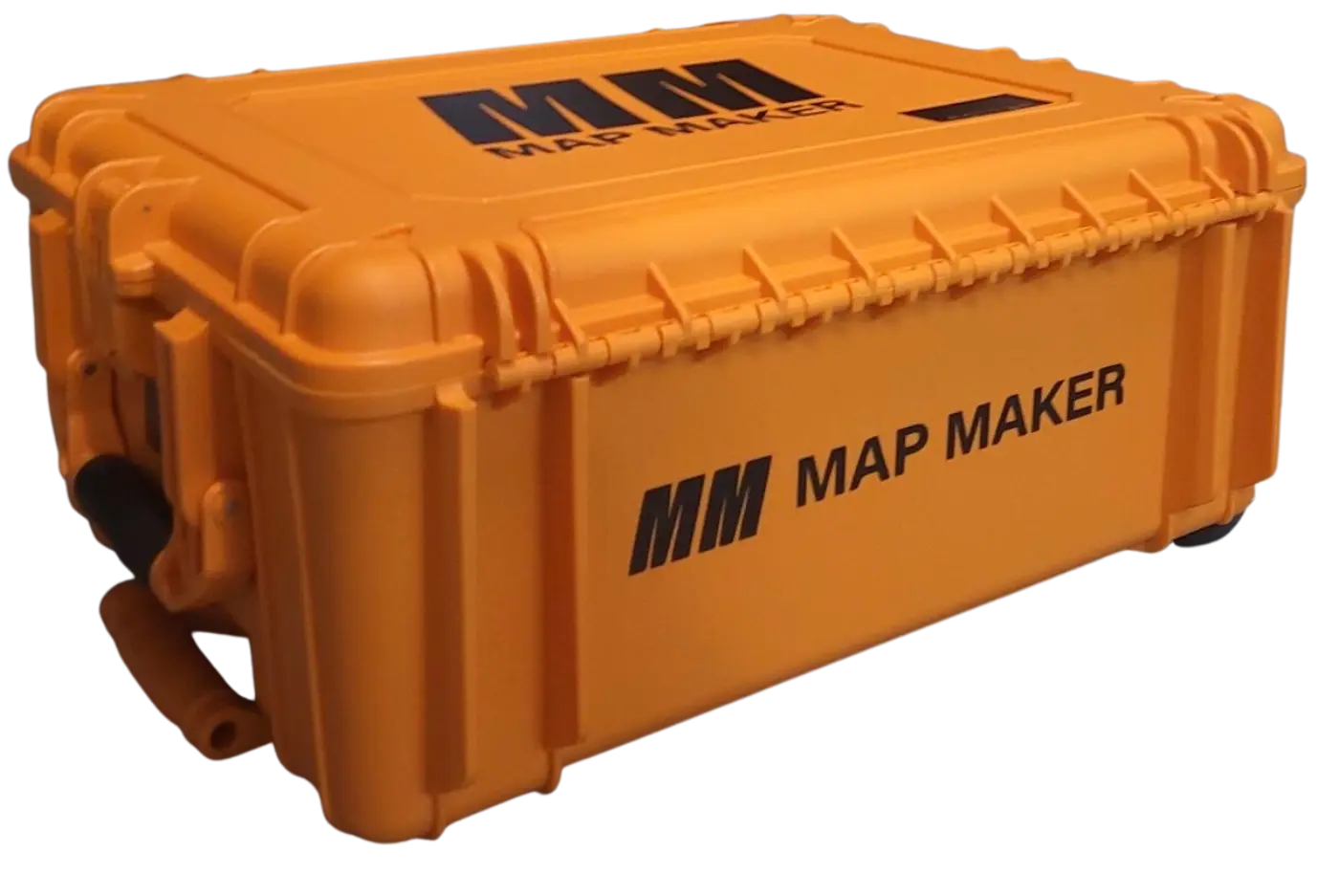
Map Maker Kits

Purpose-built, pre-configured load-outs with hardware, software, training, and 24/7 support — ready to deploy from day one.
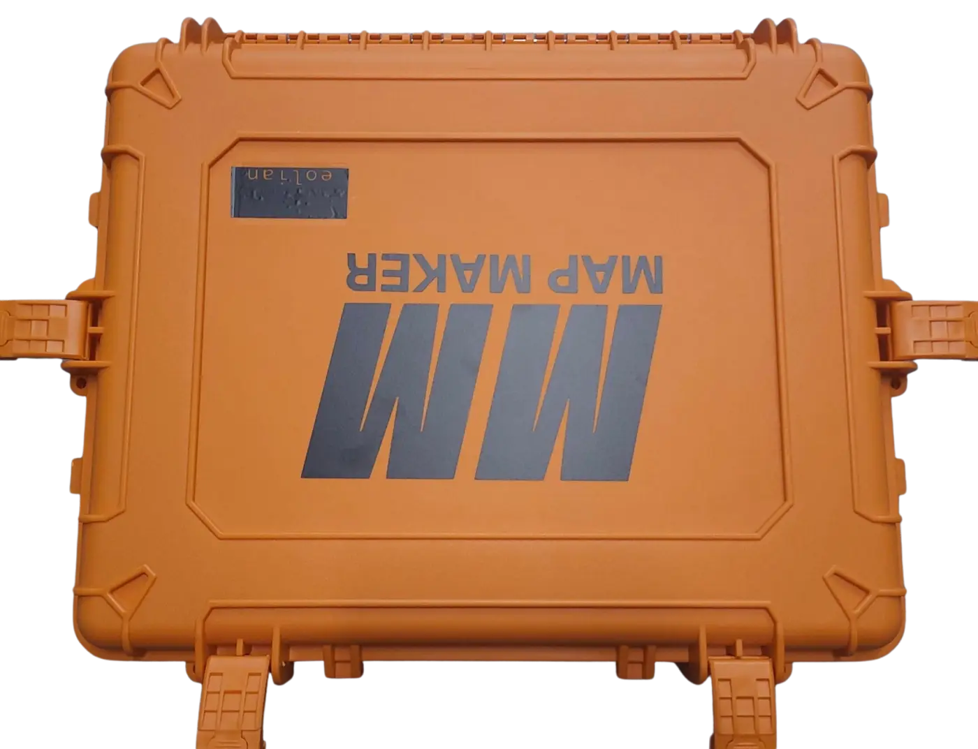
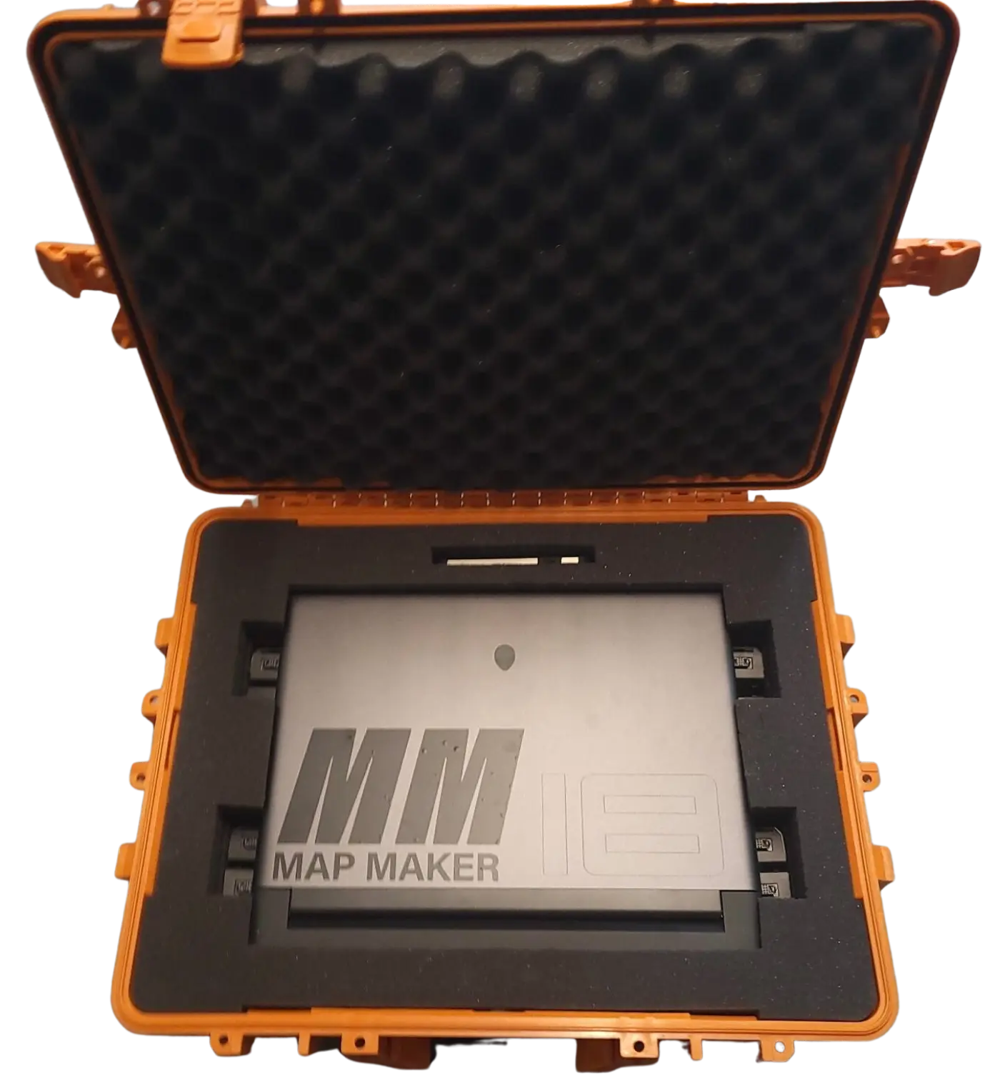
Offline Processing Kit
Software + Laptop

Offline Processing Kit

  • High-performance laptop
  • Map Maker Core software
  • On-site training included
  • 24/7 tech support
Contact for Pricing
Contact Us
Interior & Sub-T Collection Kit
LiDAR + Processing

Interior & Sub-T Collection Kit

  • Laptop + Map Maker software
  • Handheld LiDAR sensor
  • GPS-denied capable
  • On-site training & 24/7 support
$114,688
Purchase Kit
Most Popular
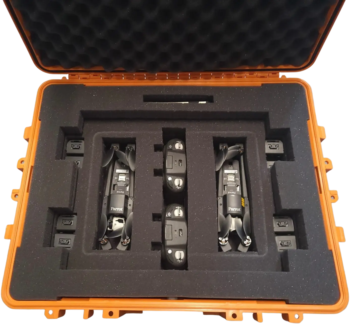
Outdoor Collection & Processing Kit
UAS + Processing

Outdoor Collection & Processing Kit

  • Laptop + Map Maker software
  • 2× Blue UAS-approved UAVs
  • Photogrammetry + video
  • On-site training & 24/7 support
$149,240
Purchase Kit
Complete Collection & Processing Kit
Full Spectrum

Complete Collection & Processing Kit

  • Laptop + Map Maker software
  • Handheld LiDAR sensor
  • 2× Blue UAS-approved UAVs
  • On-site training & 24/7 support
$207,760
Purchase Kit
Get Started

Ready to map your world?

Talk to our team about deploying Map Maker for your mission — from city-scale digital twins to underwater survey operations.